Monday, September 30, 2013

Map: Sea Beasts

Olaus Magnus' Carta Marina (via Slate)


Olaus Magnus, a Swedish Catholic priest, spent twelve years drafting this beautiful, seemingly fanciful map of northern Europe and the surrounding seas, which was printed in 1539. Head over to Slate to read more about the monsters and features depicted in cool, interactive form. 


Cool Stuff: Vintage Drafting

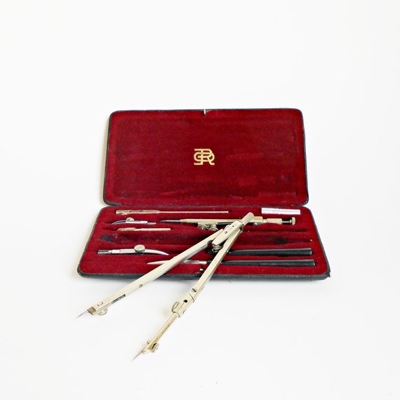
Vintage Richter Drafting Set


A beautiful midcentury Richter drafting set. (It kind of makes me want to take up hand-drawn cartography)


Thursday, September 26, 2013

Mapping Music

Over the course of the next few weeks or months, I hope to explore the geography of some of my favorite songs and artists. I know it'll be fun for me, and hopefully it'll be fun for you too.

So, to kick things off, here's one my favorite songs: Maps by the Yeah Yeah Yeahs. It actually doesn't have much to do with maps, but I still love it.


Map: Food Access Across America

USDA Food Access Atlas
In 2010, the USDA released this Food Access Atlas, which aims to map food deserts across the US. Its methodology isn't perfect-- the highlighted areas above are census tracts where a significant portion of residents live more than one mile away from a grocery store (in urban areas) or more than 20 miles away from a grocery store (in rural areas). In my opinion, a few more variables (such as availability of fresh food, vehicular and public transportation access and routes, price of food, poverty, etc.) need to be considered before declaring an area a food desert. Still, this map is a fascinating starting point to consider the geography of hunger in one's own city.

Wednesday, September 25, 2013

Cool Stuff: St. Petersburg Tea

St. Petersburg Green Tea - Kusmi Teas


This tea looks delicious (and makes me miss my Russian breakfasts- black bread, butter, eggs, and tea).


To Watch: Maps that Save the World


How crowd-sourcing maps can have an immediate and significant impact in the wake of disaster and for the future of development


Tuesday, September 24, 2013

Places: 42.567747,76.753868

Sunset over Issyk Kul- Kyrgyzstan - June 2010 - KLH Tanoue

The tumbling orb set the mountains ablaze over the dark expanse before us. The air around was still and silent apart from the rustle of leaves sent fluttering on the puff of an occasional breeze. We stood on wood worn planks over lapping waters in the shadow of twenty-thousand foot giants, young, small specks in awe of timeless grandeur. 

42.567747,76.753868


To Read: Walking New York

Adger Cowans/Getty


A profile of a New York sociology professor who spent four years walking one hundred and twenty thousand blocks (6,000 miles) in New York City, seeking to reveal the "New York Nobody Knows"

Helmreich has a theory about what gives New York’s hundreds of communities cohesion: a sense of possibility and pride. “They’re united by the feeling that they live in the world’s greatest city. This is a village, but there’s one thing that’s very important about this village.” He pointed down a narrow street to where a city bus was idling. “That bus brings you to the Empire State Building in forty minutes. It doesn’t do that in other places.”

Read the full story here.

Monday, September 23, 2013

Map: Water and Risk

Excessive Withdrawal of Renewable Water Resources - Philippe Rekacewicz


This map pinpoints places where renewable water resources are being depleted in excess, contributing to an increasing risk of drought and severe water crises. As we can see, these places exist across the world, but they are concentrated in the Middle East. The depletion of water stock may stem from a variety of reasons: pressures from a growing population, industry demands for resource extraction (often involves the use of large amounts of water), lack of large water stocks in the first place. Of particular concern is the severe lack of water stock in the Levant, where the rivers that supply much of the region's water cross multiple international borders, and competition over limited resources threatens to lead to increasing regional conflict.


Cool Stuff: Abstracted Istanbul

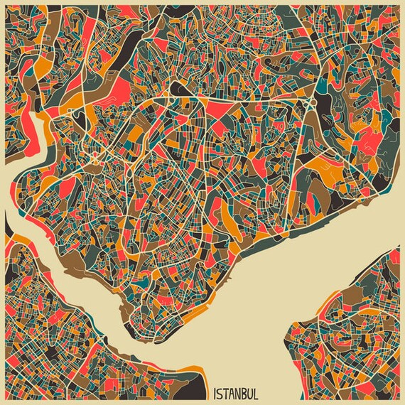
Istanbul - Jazzberry Blue

How cool is this wonderfully-abstract map of Istanbul?


Thursday, September 19, 2013

Map: International Friendships

Facebook Friendship Map - Mia Newman

You can actually learn a bit about international politics from Facebook. This cool map from Facebook's Stories site plots Facebook friendships that span international borders-- something that might tell us a bit about the relationships between those countries. Most of them are pretty straightforward, but there are a few bonds that might surprise you:

Who knew that Ukraine and Nigeria could be so closely linked?        (international students)
What about Indonesia and the Central African Republic?                   (hint: migrant labor)
The Philippines and Saudi Arabia?                                                      (also labor)    
Spain and Romania?                                                                            (you guessed it- labor again)
Somalia and Sweden?                                                                          (refugees)

Go play around a bit!


Tuesday, September 17, 2013

Map: The Racial Dot Map


This amazing map from the Weldon Cooper Center for Public Service shows a dot for every person in the United States, color-coded by race according to the 2010 US Census. It's absolutely beautiful, and it tells a really amazing story about the demographics of the US. This shot of Tucson (above) shows the dramatic shift in demographics between the northern and southern parts of the city. And, as a Tucson local, it's interesting to explore racial distributions in familiar parts of town (that cluster of red near the city center-- that's the University of Arizona). Read about the methodology and scripting behind the map here, and go get to know your city!

Cool Stuff: Orion Bracelet


How cool would it be to wear a constellation?


Wednesday, September 11, 2013

To Watch: Making Sense of Maps


Exploring the interaction between our minds and the map we make. How can we make visual representations of our surroundings that other people readily understand?


Tuesday, September 10, 2013

Cool Stuff: Geometry Daily

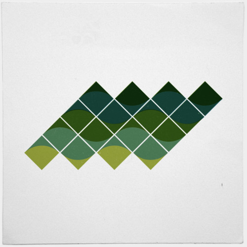
#496 Polyphonic

Geometry Daily, where German designer Tilman posts a geometric creation everyday, is one of my new favorite sites. Added bonus: You can buy all sorts of prints from his Society6 shop.


Map: World Atlas of Artificial Night Brightness

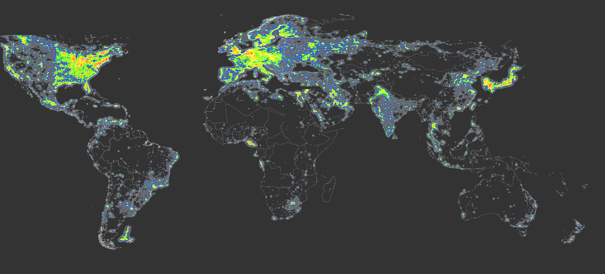
World Atlas of Artificial Night Sky Brightness - Cinzano, Falchi, Elvidge 2001

The World Atlas of Artificial Night Sky Brightness shows the extent of light pollution around the world. Light pollution is a pretty big deal, and it's not just because it keeps us from seeing the stars. The altering of nightscapes around the world impacts all sorts of living things. It affects animals' and insects' circadian rhythms, reproduction rituals and cycles, sense of orientation, and ability to obtain food, and as a consequence, it may tip the balance in favor of certain species, causing others to suffer. Check out this article on Future Tense to learn more about light pollution and some innovative solutions.


Thursday, September 5, 2013

Cool Stuff: Leather & Cedar Bike Trunk

Bicycle Trunk - sold by Anthropologie


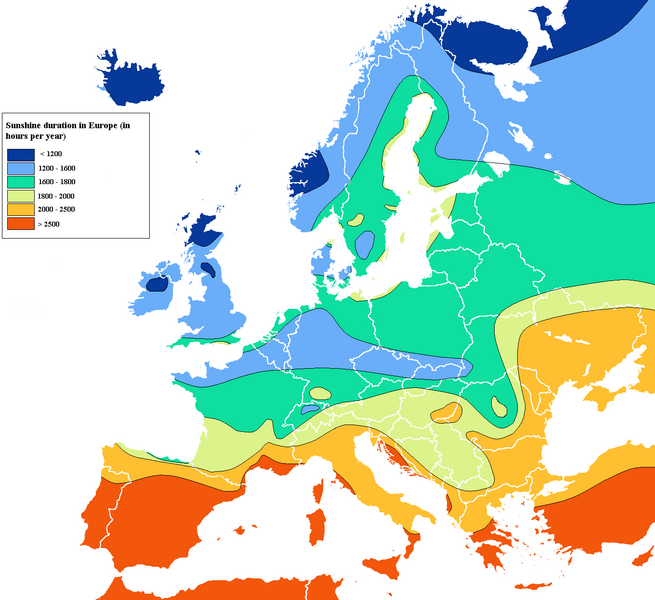
Map: Sunshine in Europe

Wikipedia Sunshine Hours Map (via SwissMiss)


This colorful map charts the duration of hours of sunshine per year across the European continent. I find the little pockets of sunshine around the Baltic Sea quite fascinating. (Also...that shady spot on the north Spanish coast is intriguing).


Wednesday, September 4, 2013

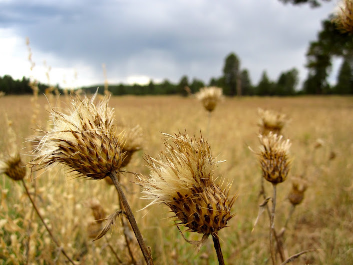
Places: 35.068081,-111.604813

near Upper Lake Mary, AZ - Oct 2010 - K.L.H. Tanoue

Autumn had just turned the green grass golden when we tramped up north for a weekend at the old elk hunt camp. The blinking bars of radio frequency fell away behind the mountains as we settled under the twisted pines and fashioned a fire for food and festivities. The smoke curled up overhead as we swapped stories and watched the stars chase the sun out of the sky. We settled in for the night and soaked in the wondrous warmth of the liminal spaces far from home.


35.068081,-111.604813


To Watch: Jerry's Map

What happens when a map takes on a life of its own?


Jerry's Map from Jerry Gretzinger on Vimeo.


Tuesday, September 3, 2013

Map: Submarine Cables

TeleGeography Submarine Map
This beautiful map by TeleGeography plots the location of all of the submarine cables crossing the globe to provide telephone and internet service across the world. Check out the full map here and learn more about the hubs and history of this international network.


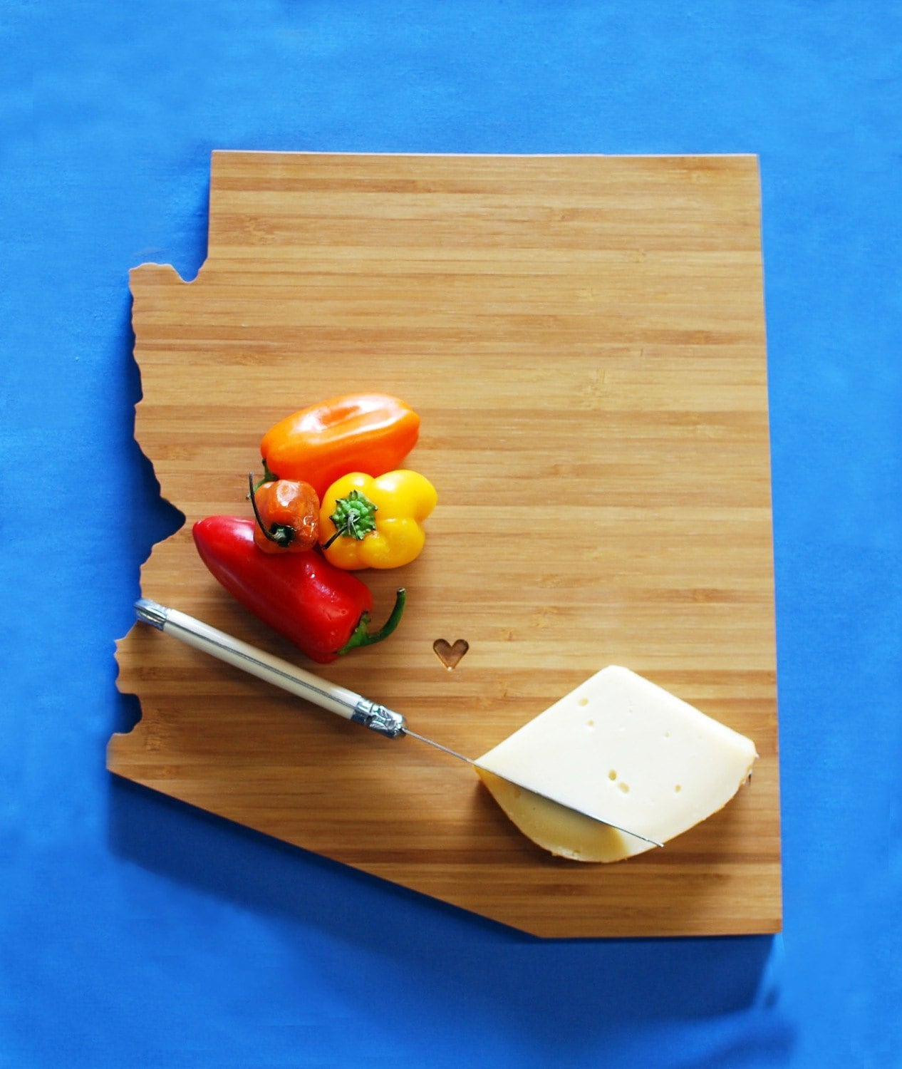
Cool Stuff: State Cutting Board

AZ State Cutting Board- AHeirloom


This Arizona cutting board by AHeirloom is gorgeous- and they make all other 50 states too!