Thursday, November 7, 2013

Map: Washington, TV

T.V. Map by Dorothy - via FastCo Design

What if all the TV shows existed not only in a single universe, but in a single city? And what if that city was Washington, D.C.? That's the concept behind U.K. Printmaker Dorothy's latest map. Click over to FastCo Design to read more about it.


Monday, November 4, 2013

Cool Stuff: Mountain Calendar

2014 Mountain Calendar - Pam Lostracco


This 2014 Mountain Calendar isn't the most practical of calendars, but it definitely is beautiful.


Map: Births and Deaths around the World

Simulation of Worldwide Births and Deaths  by Brad Lyon- via The Atlantic


This map by mathematician and software developer Brad Lyon visualizes all simulated births and deaths around the world in real time, using the d3.js library created by Michael Bostock (NYTimes graphics editor). The results are absolutely mesmerizing. It's one thing to know that, based on current birth and death rates, hundreds of people are born and hundreds others die nearly every minute. It's another thing entirely to see it. Read more about the project over at the Atlantic, or see the map in action here.


Thursday, October 24, 2013

Map: King of Beers

Beer of Choice Map - Blowfish


This map has been making the rounds on different media sites, but it's still pretty fun. According to Blowfish (maker of the map), Budweiser can no longer claim the title "King of Beers"-- instead, that title belongs to Blue Moon. Of course, what interests me the most isn't the most popular national beer, but rather the regional trends in beer preferences. Click over to Slate to learn more. 


Cool Stuff: Mini Scratch Map

Mini Scratch Map - Restoration Hardware


How fun is this mini scratch map?


Wednesday, October 23, 2013

Mapping Music: Bob Dylan

Place Bob Dylan Sang About - Bollier, Kirk, and Kreitner


Some writers at Slate created this great map with a marker for every place ever mentioned in a Bob Dylan song to mark Bob Dylan's 72nd birthday. Click over to the original article to explore all of the places!


Note: I will be creating my own maps soon- my work has just been delayed due to the government shutdown that temporarily made all census data unavailable.


To Watch: Time


This film is a compilation of the amazing comic, Time, a 3,099-frame comic that played out over the course of many weeks, with a new panel revealed every half-hour. As xkcd creator Randall Munroe explains in this blog post, the story is set thousands of years in the future during a unique geologic event in the Mediterranean Sea. I highly recommend watching the whole film and reading the post about the careful research and beautiful artwork that went into creating this unique piece.

Tuesday, October 22, 2013

To Read: The Problem with Rankings

Ranked States - Mikey Burton


This is a quick read, but a very worthwhile reminder: Don't take state rankings at face values. As a nation now obsessed with data, it's time to talk a bit about methods. Comparing diverse populations can lead to wildly misleading results. As this short article in the Atlantic shows, there can be many behind-the-scene confounding factors that contribute to a seemingly interesting statistic.


Monday, October 21, 2013

Maps: Civil War Slavery

Slave Population in the Southern States - Library of Congress


This beautiful, historic map was a favorite of President Lincoln, who studied it in great detail during the American Civil War. The map is shaded according to the number of slaves living in each county, and Lincoln found that the darker areas also corresponded to high levels of secessionist attitudes. However, as he saw and we now can see, the South was far from monolithic in its number of slaves and attitudes toward secessionism. Click over to the New Yorker to learn more about this map and the history of infographics.


Cool Stuff: Seasonal Produce Calendar

Bison Seasonal Produce Calendar


This seasonal produce calendar by Bison is quite lovely


Thursday, October 10, 2013

Cool Stuff: Travel Notebook

Travel Notebook - Wit and Whistle


I love this notebook from Wit & Whistle

Map: From ISS


Guess what this is?

It's every photo taken from the International Space Station, plotted. Which is pretty awesome if you ask me. You can read more about this map over at Future Tense. And if you want to see some of those ISS shots, head over here (once the shutdown* is over).


*A word on that: Taking the government hostage is not the way to pass or repeal legislation in a democratic republic. Please give us back NASA, the CDC, the USDA, the Census, and all the other functions that should be happening right now.

Wednesday, October 9, 2013

To Watch: Overview


OVERVIEW from Planetary Collective on Vimeo.

This film, about viewing our earth from the outside, is absolutely fascinating and beautiful.

Tuesday, October 8, 2013

Wednesday, October 2, 2013

To Watch: Bodies on the Border


Bodies on the Border from The New York Times - Video on Vimeo.


This New York Times documentary explores the human rights crisis here along the nation's southern border. To learn more about what you can do to help, head over to No More Deaths (No Mas Muertes).


Map: London, 1890

Bacon's New Map of London Divided into Half Mile Squares & Circles


This beautiful traveler's map of 1890 London is the work of George Washington Bacon of 127 Strand, London. Bacon's New Map of London Divided into Half Mile Squares & Circles depicts the city in excellent detail, with four inches to the mile. (Bonus: This map is now in the public domain, so you can print off a copy for your own collection!)


Tuesday, October 1, 2013

Places: 32.214036,-111.101478

Grant's Pass, Tucson, AZ - Fall 2012 - K.L.H. Tanoue


Bright and clear, the moon rose overhead in the dusky sky as the rocks on the trail turned to shadows. Creatures rustled through the bushes as a pair of coyotes yipped over the nearby ridge. Your feet crunched behind me in the dusty gravel as we rushed to outrun the last lingering traces of day. Tall and silent, the saguaros towered overhead, pointing upward past the creosote bushes and the jackrabbits and the rugged buttes to the expansive desert sky as night sprang to life.

32.214036, -111.101478


To Read: Revolutionizing Food

Urban Farmers Ltd - The Atlantic


Well, it's not revolutionizing food as much as how we grow food. I hope by now that you've heard of aquaponics by now. Some of you probably know all about it. For those of you who don't, here's a short and sweet guide to aquaponics and it's urban farming potential.


Monday, September 30, 2013

Map: Sea Beasts

Olaus Magnus' Carta Marina (via Slate)


Olaus Magnus, a Swedish Catholic priest, spent twelve years drafting this beautiful, seemingly fanciful map of northern Europe and the surrounding seas, which was printed in 1539. Head over to Slate to read more about the monsters and features depicted in cool, interactive form. 


Cool Stuff: Vintage Drafting

Vintage Richter Drafting Set


A beautiful midcentury Richter drafting set. (It kind of makes me want to take up hand-drawn cartography)


Thursday, September 26, 2013

Mapping Music

Over the course of the next few weeks or months, I hope to explore the geography of some of my favorite songs and artists. I know it'll be fun for me, and hopefully it'll be fun for you too.

So, to kick things off, here's one my favorite songs: Maps by the Yeah Yeah Yeahs. It actually doesn't have much to do with maps, but I still love it.


Map: Food Access Across America

USDA Food Access Atlas
In 2010, the USDA released this Food Access Atlas, which aims to map food deserts across the US. Its methodology isn't perfect-- the highlighted areas above are census tracts where a significant portion of residents live more than one mile away from a grocery store (in urban areas) or more than 20 miles away from a grocery store (in rural areas). In my opinion, a few more variables (such as availability of fresh food, vehicular and public transportation access and routes, price of food, poverty, etc.) need to be considered before declaring an area a food desert. Still, this map is a fascinating starting point to consider the geography of hunger in one's own city.

Wednesday, September 25, 2013

Cool Stuff: St. Petersburg Tea

St. Petersburg Green Tea - Kusmi Teas


This tea looks delicious (and makes me miss my Russian breakfasts- black bread, butter, eggs, and tea).


To Watch: Maps that Save the World


How crowd-sourcing maps can have an immediate and significant impact in the wake of disaster and for the future of development


Tuesday, September 24, 2013

Places: 42.567747,76.753868

Sunset over Issyk Kul- Kyrgyzstan - June 2010 - KLH Tanoue

The tumbling orb set the mountains ablaze over the dark expanse before us. The air around was still and silent apart from the rustle of leaves sent fluttering on the puff of an occasional breeze. We stood on wood worn planks over lapping waters in the shadow of twenty-thousand foot giants, young, small specks in awe of timeless grandeur. 

42.567747,76.753868


To Read: Walking New York

Adger Cowans/Getty


A profile of a New York sociology professor who spent four years walking one hundred and twenty thousand blocks (6,000 miles) in New York City, seeking to reveal the "New York Nobody Knows"

Helmreich has a theory about what gives New York’s hundreds of communities cohesion: a sense of possibility and pride. “They’re united by the feeling that they live in the world’s greatest city. This is a village, but there’s one thing that’s very important about this village.” He pointed down a narrow street to where a city bus was idling. “That bus brings you to the Empire State Building in forty minutes. It doesn’t do that in other places.”

Read the full story here.

Monday, September 23, 2013

Map: Water and Risk

Excessive Withdrawal of Renewable Water Resources - Philippe Rekacewicz


This map pinpoints places where renewable water resources are being depleted in excess, contributing to an increasing risk of drought and severe water crises. As we can see, these places exist across the world, but they are concentrated in the Middle East. The depletion of water stock may stem from a variety of reasons: pressures from a growing population, industry demands for resource extraction (often involves the use of large amounts of water), lack of large water stocks in the first place. Of particular concern is the severe lack of water stock in the Levant, where the rivers that supply much of the region's water cross multiple international borders, and competition over limited resources threatens to lead to increasing regional conflict.


Cool Stuff: Abstracted Istanbul

Istanbul - Jazzberry Blue

How cool is this wonderfully-abstract map of Istanbul?


Thursday, September 19, 2013

Map: International Friendships

Facebook Friendship Map - Mia Newman

You can actually learn a bit about international politics from Facebook. This cool map from Facebook's Stories site plots Facebook friendships that span international borders-- something that might tell us a bit about the relationships between those countries. Most of them are pretty straightforward, but there are a few bonds that might surprise you:

Who knew that Ukraine and Nigeria could be so closely linked?        (international students)
What about Indonesia and the Central African Republic?                   (hint: migrant labor)
The Philippines and Saudi Arabia?                                                      (also labor)    
Spain and Romania?                                                                            (you guessed it- labor again)
Somalia and Sweden?                                                                          (refugees)

Go play around a bit!


Tuesday, September 17, 2013

Map: The Racial Dot Map


This amazing map from the Weldon Cooper Center for Public Service shows a dot for every person in the United States, color-coded by race according to the 2010 US Census. It's absolutely beautiful, and it tells a really amazing story about the demographics of the US. This shot of Tucson (above) shows the dramatic shift in demographics between the northern and southern parts of the city. And, as a Tucson local, it's interesting to explore racial distributions in familiar parts of town (that cluster of red near the city center-- that's the University of Arizona). Read about the methodology and scripting behind the map here, and go get to know your city!

Cool Stuff: Orion Bracelet


How cool would it be to wear a constellation?


Wednesday, September 11, 2013

To Watch: Making Sense of Maps


Exploring the interaction between our minds and the map we make. How can we make visual representations of our surroundings that other people readily understand?


Tuesday, September 10, 2013

Cool Stuff: Geometry Daily

#496 Polyphonic

Geometry Daily, where German designer Tilman posts a geometric creation everyday, is one of my new favorite sites. Added bonus: You can buy all sorts of prints from his Society6 shop.


Map: World Atlas of Artificial Night Brightness

World Atlas of Artificial Night Sky Brightness - Cinzano, Falchi, Elvidge 2001

The World Atlas of Artificial Night Sky Brightness shows the extent of light pollution around the world. Light pollution is a pretty big deal, and it's not just because it keeps us from seeing the stars. The altering of nightscapes around the world impacts all sorts of living things. It affects animals' and insects' circadian rhythms, reproduction rituals and cycles, sense of orientation, and ability to obtain food, and as a consequence, it may tip the balance in favor of certain species, causing others to suffer. Check out this article on Future Tense to learn more about light pollution and some innovative solutions.


Thursday, September 5, 2013

Cool Stuff: Leather & Cedar Bike Trunk

Bicycle Trunk - sold by Anthropologie


Map: Sunshine in Europe

Wikipedia Sunshine Hours Map (via SwissMiss)


This colorful map charts the duration of hours of sunshine per year across the European continent. I find the little pockets of sunshine around the Baltic Sea quite fascinating. (Also...that shady spot on the north Spanish coast is intriguing).


Wednesday, September 4, 2013

Places: 35.068081,-111.604813

near Upper Lake Mary, AZ - Oct 2010 - K.L.H. Tanoue

Autumn had just turned the green grass golden when we tramped up north for a weekend at the old elk hunt camp. The blinking bars of radio frequency fell away behind the mountains as we settled under the twisted pines and fashioned a fire for food and festivities. The smoke curled up overhead as we swapped stories and watched the stars chase the sun out of the sky. We settled in for the night and soaked in the wondrous warmth of the liminal spaces far from home.


35.068081,-111.604813


To Watch: Jerry's Map

What happens when a map takes on a life of its own?


Jerry's Map from Jerry Gretzinger on Vimeo.


Tuesday, September 3, 2013

Map: Submarine Cables

TeleGeography Submarine Map
This beautiful map by TeleGeography plots the location of all of the submarine cables crossing the globe to provide telephone and internet service across the world. Check out the full map here and learn more about the hubs and history of this international network.


Cool Stuff: State Cutting Board

AZ State Cutting Board- AHeirloom


This Arizona cutting board by AHeirloom is gorgeous- and they make all other 50 states too!


Thursday, August 29, 2013

To Watch: 50 Facts about the 50 States

For all the other random-trivia fans out there, enjoy these fun state-themed facts:


Tuesday, August 27, 2013

Places: 50.086494,14.411346

Sunrise at St. Charles Bridge - Prague - Summer 2009 - K. L. H. Tanoue

We awoke when it was still dark, clumsily snatching clothes, tying shoes, patting pockets for metro cards. The tram lurched down the grey quiet streets past the blocks and blocks of grey apartment towers built in Soviet functionalist style until the bleak cityscape gave way to the bright red roofs of ages past. A quick jaunt across cobblestone streets carried us to the riverfront, under the shadows of church bells and silent statues, past caution tape and grey dust that warned of 'improvements', around the garbage collectors and street sweepers and other denizens of the dawn. We paused against the cold stone walls that lined the walkway above the river and waited until the sun peeked over the eastern rooftops, washing over the streets in warm golden light, marking the beginning of day.


Monday, August 26, 2013

Cool Stuff: Travel America 2014 Calendar

Travel America 2014 Calendar - Rifle Paper Company


This last year, we had this beautiful, illustrated cities calendar by Rifle Paper Company hanging on our kitchen wall. I think that this Travel America calendar would make a great follow-up.


Maps: Every Library and Museum in America

Map of Public Libraries across the US

For the National Day of Civic Hacking, Grimes built this wonderful map of all 17,000 libraries in the US (that's more than Starbucks or McDonalds franchises, thankfully). This vast public library network manages to serve nearly 97% of all Americans.


Map of Museums across the US

There are even more museums (about 35,000) across America. These institutions (including zoos, aquariums, art galleries, arboretums, and more) seek to educate the public about some collection of some kind of things. 

I take joy in seeing the reach of both the museums and libraries and comfort in knowing that, at least for now, you are more likely to find a place serving the education of the public than you are to find even the most ubiquitous fast food joint. 


Thursday, August 22, 2013

Cool Stuff: Corkboard World Map

corkboard map - anthropologie


I'm really digging this corkboard world map by Anthropologie (even if the projection is terrible).

Map: Location and Life Expectancy

DC City Map - Robert Wood Johnson Foundation
Geography is a huge factor in public health. Like it or not, the place where you grow up has a tremendous impact on your likelihood of living a long and healthy life. Factors such as stress, walkability, public resources, community cohesion, food access, air quality, educational opportunities, and many more influencing factors that impact individual and community health depend in part on geography. And, as these maps by the Robert Wood Johnson Foundation show, slight changes in location can greatly change health outcomes. Check out the full report here. 

Wednesday, August 21, 2013

To Watch: Address is Approximate


An adorable, stop-motion animated, Google Streetview short film about a wanderlust-filled desk toy by Theory and Google Street View.


Places: 37.826192,-122.479155

San Francisco, CA - July 2009 -  K.L.H. Tanoue
That morning on the over-crowded bridge the fog hung thick and low, a collapsing tent straining under the weight of storms above. Arizona tourists we were, huddled in landmark-emblazoned fleeces in the winter-like summer cold. My body complained loudly after the 8-hour-car-drive that had followed the 14-hour-plane-ride from a place where peanut butter was unheard of and people were protesting a missile defense system. It was our last family vacation before my belongings-laden car struck out for independence in a town down southwest. We stood admiring the ships and the waves until your fingers and lips began to turn blue and we piled back inside to continue up the coast.

37.826192,-122.479155

Tuesday, August 20, 2013

To Eat: Proper

Proper's Foodshed Map
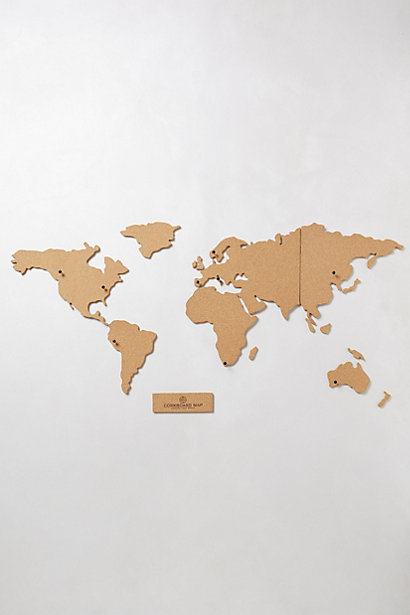
Disclaimer: I am posting this restaurant review mostly because of their cool map. My food preferences are indeed swayed by my geography-nuttiness.

Proper is a fun little restaurant that opened recently down on Congress and 5th Ave in downtown Tucson as part of Tucson's downtown restaurant renaissance. They focus on locally-sourced food and drinks served in an artful manner in a cozy corner of the historic Rialto building.

Reasons we love them:

1. Local food. In a time when the sources of most of our food are obscured by commercialized commodity chains, it's great to know where your food is coming from. The fact that Proper maps and publishes their food sources allow the consumer to do their research.

2. Tasty food. The House Board is awesome (it includes amazingly delicious duck and rabbit! - plus cheese and other goodies), and the churros are to DIE for. (Our favorite dinner arrangement= house board, 2 small plates, and churros to share)

3. Delectable (local) drinks. There's a wide selection of beers from AZ breweries on tap, as well as a number of local wines. Right now, Nate and I recommend the Four Peaks Brewery Peach Ale.

4. Did I mention their awesome map? I recommend sitting under the giant version of it on the back wall.


The Place:  32.222005,-110.966954
                 Proper | 300 E Congress St. | Tucson, AZ 85701
Hours:        M-F | 11am-Midnight
                 Weekends | 9am-Midnight


To Read: Maps, Moscow, Bikes, and Movements

Photograph by Mikhail Metzel/AP


Can bikes change the world?

I found this New Yorker article by Sally McGrane on a new bike share program in Moscow. From its exploration the tremendous impact of maps to project a movement's vision for the future to its commentary utility of bikes for political activism, it's definitely a worthwhile read.

(P.S. Want to know more about current political movements in Russia? Check out this article)

Monday, August 19, 2013

Cool Stuff: Soviet-era Typewriter

Vintage Manual Typewriter - The Things that Were

This probably only interests the Russian-nuts like me, but I love it so much. Cyrillic keyboard, and it's orange!


Map: Craft Beer across the U.S.

US by Total Breweries - New Yorker Interactive Map


This awesome, interactive mapping project by the New Yorker visualizes the craft-brewing explosion across the United States. Go check out the maps to see stats on craft beer production, growth, and density for all fifty states, as well as some neat brewery stats. See highlights of the project in this post by Daniel Fromson.


Friday, August 16, 2013

Happy Friday!


Evening Hymns - Arrows - Cardinal Sessions


It's finally the weekend! I hope you have fun weekend plans. Nate and I are planning to make it down to Peach Mania at Apple Annie's orchard in Willcox to pick some peaches fresh off the tree. Plus there will be plenty of trips to the dog park for Watson (and lots of studying for Nate).

Typographic Food

Applying science to build a better pie

DIY Rope Bag

A foldable bike helmet

Find the legos

Innovative and compassionate care for dementia patients

Nate's birthday gift (it's a hit!)

Soviet microscope

How sperm whales hold their breath so long

Caring for your introvert


Have a wonderful weekend!!


Thursday, August 15, 2013

To Watch: A Place at the Table


This documentary, exploring the reasons why many families go hungry in a nation with abundant food resources, is first on my next-to-watch list.


Cool Stuff: Molecule Puzzle

Molecule Puzzle by SiamCollection
If I had money to spend on knick-knacks, my desk would be a very crowded place.


Wednesday, August 14, 2013

To Watch: An Epic Fall


I greatly enjoyed Braniac Tuesday from YouTube Geek Week. This video was my favorite of the bunch. (Who doesn't like to watch free falls into ball pits for science?)


To Eat: Cheese

La Tur: F. Scott Fitzgerald
Cheese is the reason I can't stay vegan. This post from the Airship Daily on exceptional cheeses and their literary counterparts makes me want to throw a cheese-and-reading party for my birthday.


Tuesday, August 13, 2013

Places: 21.347104, -157.893036

Monkeypod Tree by K.L.H. Tanoue
The monkey pod trees stretch up and out, towering branches forming fractal patterns against a thick morning sky, dropping dark shadow against the spreading carpet of lush green grass. Koi swim lazily through the murky green waters, gleaming gold and white along the occasionally sunbeam. Bright bamboo tower over the stoic teahouse with pagodas pointed toward the trees above. Japanese tourists dot the lawn, snapping pictures and flashing peace signs in front of the tree claimed by a corporation whose advertising allows the gates of this royal estate to remain open for no cost. We wander, admiring flowers and capturing a few memories ourselves, enjoying the delicious silence amidst organic giants.

21.347104, -157.893036